The Drone Roof Inspection Revolution: Why Drones Are Redefining Building Intelligence
Bilal S.
Founder & CEO - BDR
Introduction
It’s easy to dismiss drones as just flying gadgets. People see them delivering packages, taking wedding photos, or shooting action sports. But fly a drone above a cityscape, point its camera toward a building roof, and you’re peering into a future where risk plummets, accuracy climbs, and information becomes leverage in building maintenance. Drone technology is not about gadgets; it is about multiplying your capabilities, minimizing your liabilities, and, if you do it right, expanding your understanding of the built environment to a level we simply could not access before.
In this comprehensive breakdown, we’ll connect the dots between platforms, AI, workflow, and compliance, showing not just what’s possible but how the best in the business turn an aerial survey into actionable, safety-first intelligence.
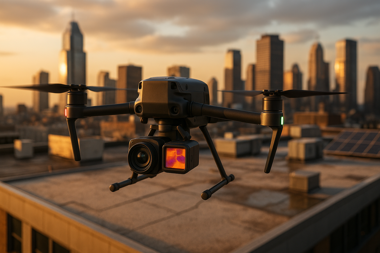
Drones: Platforms Built for Precision (and Why Their Weaknesses Matter)
Let’s break the myth: not all drones are the same. The machine you buy for your weekend mountain shots is a different beast from the one a pro uses for roof inspection. You must pick the right horse for the race, or you won’t even finish. Winning will be out of the question.
Platform Choices:
- Fixed-wing drones are marathoners. They cover acres fast but struggle in tight urban spaces.
- VTOL and tilt-rotor models can take off/land in a parking lot, navigate around chimneys, and hover for detail shots. They shine in cities or on complex, multi-tiered roofs.
Sensors That Tell the Truth:
Modern drones are sensor platforms with purpose. High-res RGB grabs the big picture. Thermal sensors (think FLIR, ICI Mirage 640) reveal soggy insulation invisible to the human eye. LiDAR uncovers minute deformations. Dual payloads stack the data.
The Limiting Factors:
- Payload: Each sensor adds weight, costs battery, and eats at flight time. Flight duration is usually limited to 20–30 minutes.
- Environmental Constraints: Wind, rain, or even poor light can downgrade image fidelity or divert a flight altogether.
- Navigation: That GPS lock is reliable in open sky, but spotty in “urban canyons.” Backup methods like SLAM and visual-inertial odometry are becoming essential.
- Data Quality: If the hardware or the mission plan is suboptimal, you’ll miss subtle but critical cracks.
What does this all add up to? Drones are disruptive, but only if you manage the logistical, technical, and physical constraints. Capabilities multiply, yes, but only if you plan for the inevitable bottlenecks.
Intelligence in the Sky: The AI That Spots the Invisible
Collecting images is one thing; knowing what matters is another. A roof is a chaotic landscape to a computer: shingles, HVAC units, shadows, debris. The only way to filter noise from gold is advanced, context-aware algorithms.
Deep Learning Models:
- Segmentation Networks (e.g., RRD-SegNet): These don’t just say “there’s damage”; they paint masks on cracks, flaking, or curled edges, pixel by pixel. This means you get precise scope and quantification of every defect, which is critical for maintenance budgets and urgent interventions.
- Object Detection Models (YOLO variants): Fast and practical, but less granular. These models quickly flag defects but may fudge the line between, for example, hail bruising and shingle curling.
Bottlenecks to Intelligence:
- Roofs aren’t just asphalt shingles in bright daylight. Variability such as lighting, shadow, and material wrecks detection rates.
- Not enough annotated datasets. Most models are trained on a narrow band of roof types (asphalt, maybe tile). Expansion is slow.
- Drones need lightweight, efficient models. You can build a rocket-ship model in the lab, but can your drone actually run it?
Defect Tracking Makes a Difference:
Why just detect when you can track? Video modules like RDIM keep a persistent eye on defects, which is essential for progress tracking and post-event analysis. You move from static reports to a dynamic logbook of your asset’s real health.
Compliance: Navigate the Regulatory Gauntlet or Face Grounding
You can’t innovate if you can’t operate. This is where most practitioners trip; it isn’t the hardware or AI. It’s the alphabet soup of regulations that keeps you on the ground if you get this wrong.
US Rules (FAA Part 107):
- Pass a knowledge test. Carry the cert.
- Stick to VLOS, below 400 feet, don’t fly over people without a waiver.
- Airports? Special authorization required.
Europe (EASA):
- Categories: Open, Specific, Certified. Most roof work is Specific, which requires risk assessment and authorization.
Key Pain Points:
- BVLOS and Night Flights: Mostly off-limits.
- Urban areas: Complex issues include privacy, safety, and airspace congestion. Bureaucracy meets operational risk.
- Data Protection: If you’re flying above people’s homes or workplaces, privacy violations can land you in hot water.
Operator training, liability, and insurance aren’t just legal boxes. They are business-critical. If your operator misreads a wind gust or your data leaks, you could lose everything.
Workflow: From Flight to Insight Without Dropping Data (or Quality)
Imagine this: you fly the mission, collect a terabyte of images, and… now what? If you don’t have a workflow, you have chaos.
Acquisition: Rigorous flight planning assures coverage and overlap (70–80% is baseline). Ground Control Points (GCPs) and RTK-GNSS let you geolocate every pixel with confidence.
Photogrammetry/3D Modeling:
- Structure from Motion (SfM): Converts raw images into dense spatial models.
- Multi-View Stereo (MVS): Adds fine detail.
Post-Processing and AI Analysis:
- Automated segmentation and detection turn images into actionable maps.
- Noise reduction, semantic labeling, and defect quantification set the data up for engineering decisions.
Data Management:
- Cloud storage isn’t optional. Metadata tagging and retrieval are what separate scalable operations from one-off jobs.
- Security isn’t an afterthought. Compliance with privacy/IT standards is non-negotiable.
BIM Integration:
Here’s the leap: Take that processed, geolocated roof model and export it in a BIM-compatible format (IFC, Revit). Now, not just you, but every stakeholder such as the owner, insurer, and contractor sees the same reality, in context, in real time.
The real meta-skill? Smoothing the rough edges between UAV data and BIM standards, so your insights don’t get lost in translation.
The BIM Multiplier: From Inspections to Intelligent Buildings
Imagine not just visualizing your roof, but embedding its true condition into your digital building replica. Welcome to the next frontier:
- Enhanced Visualization: You see problems in place, on the asset, in 3D, and over time.
- Process Automation: Defect data flows directly into maintenance schedules, deviation logs, or procurement workflows.
- Digital Twins: The holy grail includes continuous monitoring, predictive analytics, and simulation for risk mitigation.
Emerging Synergies:
- AI and machine learning amplify predictive maintenance.
- AR/VR give every stakeholder an immersive inspection without the need for hard hats.
- Real-time twins mean you spot, simulate, and solve before the first raindrop falls.
But there are trade-offs:
BIM integration is only as good as your interoperability standards, data volume management, and, crucially, the people you train. If your team can’t move nimbly between drone software and BIM systems, you’re dead in the water.
The Playbook: Thinking Beyond Tools to Systems
Useful drones in roof inspection aren’t about jumping on a tech bandwagon. They’re platforms for creating systems, where every step, from flight plan to AI to BIM, is integrated and optimized.
If you want to dominate this field, calibrate your approach to solve for:
- Maximizing Your Uptime: Pick hardware and software that thrive in the real world, not just in vendor brochures.
- Multiplying Your Insight: Use defect detection not as an end, but as actionable data that drives maintenance, budgeting, and safety.
- Navigating Compliance: Stay ahead of rules so you aren’t grounded by red tape.
- Perfecting Workflows: Build or buy workflows that take you from image to insight without bottleneck.
- Leveraging Integration: Don’t let data die on devices; instead, let it live in the systems where decisions are made, such as your BIM or your digital twin.
Those who solve this system equation won’t just inspect roofs; they’ll build safer, smarter buildings and outpace those still stuck on ladders, hoping for the best.
References
- Brodbeck, K. (2022). Advances in Thermal Imaging Drone Technology Greatly Improve Commercial Flat Roof Inspection Efficiency. Roofing Contractor.
- Li, H., Borodin, W., & Kim, J. (2023). UAV-based Construction Inspection: Challenges and Future Research Directions. Journal of Construction Engineering and Management.
- Rafiei, M., et al. (2024). RRD-SegNet and RDIM: A specialized deep learning pipeline for automated roof defect detection and tracking. Journal of Computer Vision in Civil Engineering.
- Zahradník, D., Roučka, F., & Karlovská, L. (2023). Flat Roof Classification and Leaks Detection by Deep Learning. Civil Engineering Journal, 4(2023).
- Zhao, X., & Jebelli, H. (2025). A computational method for real-time roof defect segmentation in robotic inspection. Computer-Aided Civil and Infrastructure Engineering.
- Waterston, W. (2016). Drones For Building Inspection. Building Enclosure Online.
- FAA. (n.d.). Part 107 Small UAS Rule. Federal Aviation Administration. https://www.faa.gov/uas/commercial_operators/part_107/
- European Union Aviation Safety Agency (EASA). (2018). Introduction of a Regulatory Framework for the Operation of UAS in the "Open" and "Specific" Category. https://www.easa.europa.eu/document-library/opinions/opinion-no-01-2018
- Anumba, C. J., et al. (2020). Construction 4.0: An Innovation Platform for the Built Environment. Routledge.
- Colomina, I., & Molina, P. (2014). Unmanned aerial systems for photogrammetry and remote sensing: A review. ISPRS Journal of Photogrammetry and Remote Sensing, 92, 79–97.